Response
Council and community
responses
Management of
Beaches
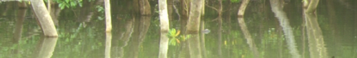
Cungulla
Coastal Solutions
Protected Areas
Non
Governmental Groups
Future Directions
Council and community responses
In
response to many of the problems of the local area, Council has
adopted an Integrated Coastal Zone Management approach. This approach
recognises the lead roles of other Federal and State agencies in
relation to coastal and marine environments, but endeavours to meet
the responsibilities of local government in a way which ensures
that local programs are co-ordinated and complementary.
In
order to stabilise beaches at Pallarenda and on the strand, sand
renourishment and other appropriate actions have been taken to reduce
pressure on coastal dunes. As well Council has supported Catchment
management programs, work by local Coastcare
groups, enhanced response to pollution incidents, integrated
and cooperative water quality monitoring, and the development of
environmental partnerships with Townsville Port Authority (TPA).
Council
has provided support to community estuarine monitoring with funding
for a small boat and water quality monitoring equipment purchase
for the RIVER group.
Council
has been involved in supporting local Coastcare activities
and groups at Cungulla (since 1994); Pallarenda; and West Point
(MI). This support, part funded by NHT Coastcare, has included dune
revegetation & coastal tree planting; beach cleanup; signage,
bollarding and beach access.
In
addition Council supported by 50:50 funding from the Beach Protection
Authority was involved in fencing and revegetation of the dunes
from Rowes Bay to Pallarenda from 1994-1995.
Council
attends the Townsville Local Marine Advisory Committees so it can
remain abreast of marine and coastal current and emerging issues.
This also gives Council an opportunity to report on its own environmental
activities in water quality and coastal management.
Townsville
City Council in partnership with Townsville Port Authority and Conservation
Volunteers Australia produced a stormwater and estuarine pollution
brochure to focus on community involvement and ownership in protecting
our estuarine and urban waterways.
James
Cook University and Townsville City Council have commenced working
together tpo promote the environmental values of the otherwise unknown
Rowes Bay Intertidal Flats and mini-estuaries (Ryan Street and Esplanade).
This work has consisted of research by JCU (Marine Biology, beach
cleanup (clean-up
Australia Day 2004), and education and awareness campaign (envirofund
interpretation project and sponge
garden tours).
Recently,
Council has joined forces with the EPA and City of Thuringowa (CoT)
to establish the "Creek
to Coral" program. Creek to Coral is an infrastructure
based project to promote and protect the marine environment and
our water resources from the impacts of landbased pollution. The
program supports and seeks to involve community-based environmental
initiatives (NaREF, Landcare, Creekwatch, Indo-Pacific Sea Turtle
Conservation Group, Seagrass Watch and ReefCheck).
This program is consistent with "thinking globally and acting
locally" and supports the United Nations efforts and programs
to protect the marine environment from landbased impacts (see Hilltop2Oceans
- TypeII international partnership agreement)
Management of Beaches
Coastal
management of beaches is a State responsibility under the Beach
Protection Act.
The
Beach Protection Authority is responsible for overseeing the protection
and management of beach and dune areas along the Queensland coastline.
Their traditional view is that although the Rowes BayPallarenda
system is losing sand, this is part of normal coastal regression
following development and eventually the coastline will reach an
equilibrium (BPA pers com) in the area. This takes into account
that there was more than 200 metres of coast lost to current housing.
However, it did not take into account protection of road and other
infrastructure assets closer to the beach.
The
State does offer a foreshore protection subsidy of 25% for coastal
works (sand renourishment etc). In 1997 beach profiles of Rowes
Bay were increased over a 100 meter stretch of sand in the key eroding
area of beach change. In January 1998 following Cyclone Justine
TCC Environmental Services was able to demonstrate significant coastal
erosion from the storm. Subsequently the department was successful
in obtaining funding for beach restoration to pre-Justine conditions.
Since this time Council has conducted two further sand renourishments.
Survey
reports of the area show that with sand renourishment in place for
three years the foreshore sediment budget calculations show that
over 60% of the sand placed there since late 1998 remains in the
nourishment zone (
Monitoring Report 3 - Mabin 2001).
In
this time the beach has withstood the effects of a Category 2 tropical
cyclone, and several other high-energy wave events (Report
on Cyclone Tessi 2001).
Where
sand has moved it has moved south to within Rowes Bay and has
not been lost from the system at all. Survey in fact shows that
longshore drift to the north has been minimal during the time.
This
is due to the effect of more northerly winds. However as was known
from the beginning the beach has not been returned to a pre-Cyclone
Althea state and a significant additional sand nourishment program
would be required with annual renourishment.
Options
for groynes are limited in the area and aesthetically may not be
acceptable on a broad beach such as Rowes Bay Pallarenda. In addition
they can cause erosion problems.
Whilst
groynes have proved an ideal solution in the compartmentalised conditions
of Breakwater to Kissing Point headland feature (The Strand). These
groynes are deliberately positioned to ensure sand is locked within
the Strand beach/rock system and provide headland type features.
Recently
an Honours student from James Cook University has determined the
critical erosion point for sand renourishment in Rowes Bay (south
of RSL villas) and found that the beach is in good condition, despite
the obvious visual affect of the scarp (JCU pers.com.)
Also
see "Environmental
History of Rowes Bay" by Dr.M.Mabin (James Cook University)
Cungulla Coastal Solutions. In response to concerns from residents
in the Cungulla township TCC commissioned a beach erosion review
by Professor Hopley and Dr Rasmussen (see Report 1995).
The results of the review were discussed at community meetings with
residents of the township. Since this time there has been a significant
beach clean up of debris and tyres (200 ton); annual beach profiles
have been undertaken, and Coastcare activities have
continued (including tree planting, access and vehicle management).
Recently
the local community recreational fishing group have got together
and are working with Council on provision of permanent access to
the Doughboy Creek boatramp. All approvals are in place and Council
is currently in process of having USL land placed in a Reserve for
Environmental Purposes in order to manage the access with the residents.
Protected Areas
 Marine
Parks adjacent to Townsville - LGA
Marine
Parks adjacent to Townsville - LGA
Coastline:
Map ©, Geoscience Australia. www.ga.gov.au
Data: GBRMPA
 Fish
Habitat Areas - FHA
Fish
Habitat Areas - FHA
Coastline:
Map ©, Geoscience Australia. www.ga.gov.au
Data: GBRMPA
 Dugong
Protect Areas - DPA
Dugong
Protect Areas - DPA
Coastline:
Map ©, Geoscience Australia. www.ga.gov.au
Data: Queensland Fisheries Service
Visit
the Great
Barrier Reef Explorer

The
new State
Coastal Management Plan has been adopted to address the issues
and pressures associated with coastal development in Queensland.
View here for Coastal
Management in Queensland.
-
Schedule 1 - Regional
Overview (pdf 960kB) of Queensland Coast,
Environment and Settlement
- Schedule
2 - Scenic
Coastal Landscapes (pdf 74kB) of Queensland
Coast (discusses Townsville Coast as "High Scenic Management Priority").
Queensland
Department of Primary Industries, Queensland Fisheries Service,
has recently completed a coastal wetland mapping project and subsequent
document; Queensland coastal wetland resources (Cape Tribulation
to Bowling Green Bay).
Non Governmental Groups
A
number of community and other Non-Governmental Groups have been
formed that show an interest in the sustainable management of Cleveland
Bay and coastal environments. Amongst these are the Cleveland
Bay Consortium (CBC), RIVER Group, Indo-Pacific
Sea Turtle Conservation Group, and Townsville-Thuringowa Landcare
Association/Natural Resource and Environmental Forum (NaREF).
The
Cleveland Bay Consortium
The
Cleveland Bay Consortium is an informal industry/research
forum for the discussion of the sustainable use of the environments
of Cleveland Bay.

Industry
and regulatory agencies in the Cleveland Bay region have identified
a need for comprehensive information about water, sediment, flora
and fauna of the Bay for environmental license applications and
future planning for sustainable use of the region. Information from
past research is often difficult to find, of variable quality, and
is sometimes difficult to apply to current problems and applications.
Business, industry, regulatory authorities, and research agencies
identified a need for a focus or forum to exchange information,
priorities, information needs, and expertise. The CBC has recently
released a Status
Report for the Cleveland Bay.

A
Community Plan for Natural Resource Management in Townsville-Thuringowa

Produced
by Townsville Thuringowa Landcare Association

Coast and Marine Environments
For a traditional owner view of Townsville's Coastal and Marine
environment click here:
Strategy
4.7 Traditional Use of the Coast and the Sea
The
River Group
Ross
Island Volunteers for Estuarine Rehabilitation (RIVER): a, volunteer,
environmental monitoring group which aims to raise community awareness
of the importance for biodiversity and productivity and the vulnerability
of our river systems. Its main objective is to involve the community
in collection of background data on these systems. Volunteers can
participate in various activities ranging from assisting with school
programs and conducting guided walks and talks for the public, to
collecting monitoring information.
Rivers
Report here
Contact
David
Reid of RIVER Group

Green
Turtle, Dugong & Calf, Flatback , Hawksbill
Photos courtesy of GBRMPA
Indo-Pacific
Sea Turtle Conservation Group

Primary
objectives of IPSTCG
Sea
Turtles in the Townsville Region (.pdf
320KB)
- To
increase numbers of sea turtles which forage and nest in the Indo-Pacific
region. To secure and expand existing sea turtle nesting and foraging
habitats in the Indo-Pacific region.
- To
identify and minimise threatening processes to sea turtle populations
in the Indo-Pacific region.
-
To design and deliver education programs to promote community
awareness of the threats to sea turtle populations and inspire
proactive solutions to diminish those threats.
-
To encourage government agencies and commercial organisations
to be pro-active in providing effective solutions to identified
threats to sea turtle populations.
-
To encourage indigenous groups, who hunt sea turtles and harvest
eggs for culturally significant purposes, to regulate sustainable
levels of take.
-
To conduct research, collate data and deliver factual and unbiased
information on the status of sea turtle populations, in the Indo-Pacific
region.
- To
maximise funding and other resources available to achieve the
ecological sustainability of seas turtle populations
OUCH
Volunteers - Townsville
O.U.C.H
(Order of Underwater Coral Heroes - 'Working to protect the Coral
Reef Environment") is a community initiative to promote the
protection of reefs and seagrass beds throughout the Great Barrier
Reef Marine Park. This program as part of Queensland DPI Seagrass
Watch, won the Prime Minister's Environmental Award on Australia
Day 2000, for their work in Reef Protection. This work included
the Reef
Protection Markers which following the success in the Whitsundays
is about to be installed in bays of Magnetic Island by QPWS.

Reef
Protection Marker
This
group has previously conducted a sea bottom cleanup of Florence
Bay with 21 volunteer divers in 2000 and others with smaller groups
in the Outer Reef. Overall, over 200 kilos of rubbish (dry weight)
has been collected from the local sea-floor.
O.U.C.H.
(Order of Underwater Coral Heroes)
Local
contact Luis
Sanches - (OUCH Townsville)
Future Directions
Maintain
an Integrated Coastal Zone Management approach to managing Townsvilles
marine and coastal resources, including consideration of both estuarine
and catchment management initiatives.
Promote
opportunities for ongoing research through various organisations,
which can greatly assist Townsville City Council in the development
of management plans for estuarine and coastal locations (eg. seagrass
monitoring with CRC and beach survey with JCU TESAG).
Continue
to enhance and develop business and community partnerships, which
demonstrate commitment to managing our coastal resources and environment.
Go
To Top |